 |
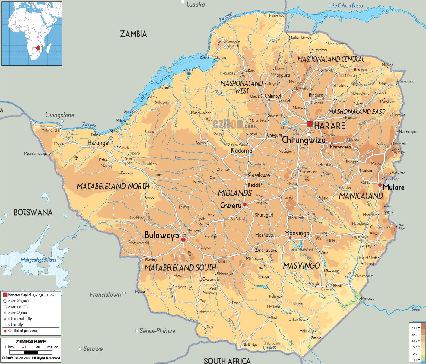
| This map of Zimbabwe is from http://www.ezilon.com/maps/images/africa/Zimbabwe-physical-map.gif |
Size- Zimbabwe has a total area of 390757 square kilometers, about 386,000 sq km land, and about 4000 sq km water. This is approximately 5% of the total area of the United States of America.
Terrain- Zimbabwe consists of mostly plateau highlands, and most of the country sits at a higher elevation. Elevation rises towards the east because of the mountains. (Eastern Highlands) Lake Kariba sits on Zimbabwe's northern border and takes up 1% of the country's total area.
(https://www.cia.gov/library/publications/the-world-factbook/geos/zi.html)
(https://www.cia.gov/library/publications/the-world-factbook/geos/zi.html)
No comments:
Post a Comment